Midwest, parts of northern New England could see 1st snow of the season
Written by ABC Audio ALL RIGHTS RESERVED on November 8, 2025

(NEW YORK) — Americans in parts of the Midwest to northern New England could see their first snow of the season early next week due to an arctic blast.
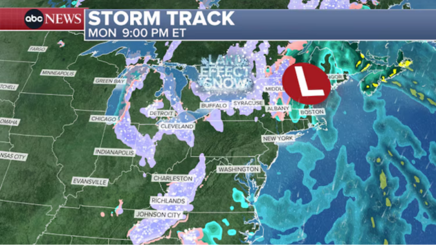
The very warm Great Lakes combined with arctic air will kickstart the lake-effect snow season late this weekend into the new workweek, but this will not be historic snowfall by any measure.
A Winter Storm Watch is in effect for Chicago and South Bend, Indiana, from late Sunday night through Monday afternoon for potentially heavy lake-effect snow. Snow rates exceeding 2 inches per hour, event snow totals up to 6 inches and over 35 mph wind gusts are possible.
While this snow will be very localized and most areas are not expected to see accumulating snow, this combination will likely produce slick and hazardous driving conditions during the morning commute and afternoon on Monday.
Winter Weather Advisories are currently in effect in parts of the Upper Peninsula and northern Wisconsin until Monday afternoon for lake-effect snow bringing between 2 to 5 of total snow and up to 8 inches in localized areas.
By Monday into Tuesday, the first lake-effect snow event will begin to set up in the eastern Great Lakes from Erie to Buffalo and possibly Syracuse.
Some areas off the lakes could see a few inches of snow, but it’s still too soon to know exactly how much will fall and where. Also, reiterating that this will not be historic lake-effect snow by any measure.
The interior Northeast from Appalachia to Pittsburgh up to northern New England could also see its first snow late Monday through Tuesday.
This snow will not stick around for long, as warming temperatures next week will quickly melt any snow that sticks to the ground with this quick blast of arctic air.
Copyright © 2025, ABC Audio. All rights reserved.


